“STRONGs” Photo Gallery - 3
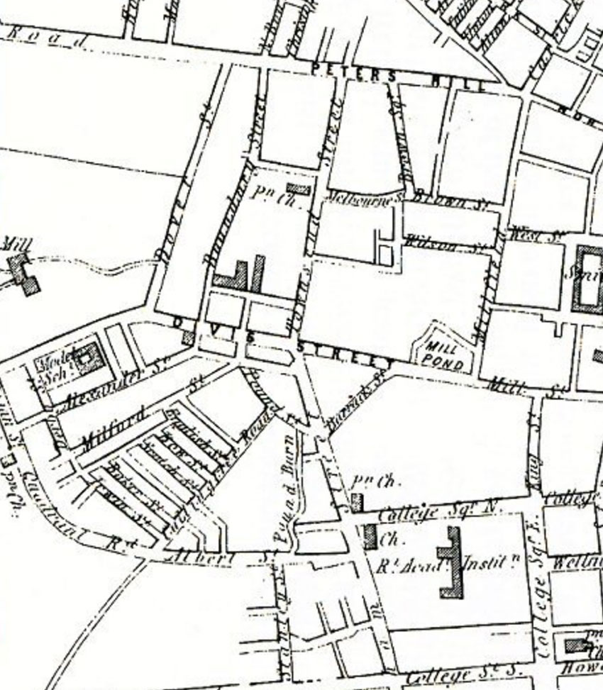
Please try this tour. Find Townsend St. & Boundary St. Go S down Boundary St until you reach the beginning of Divis St. At W of the intersection, Divis becomes Falls Rd. and the Falls Rd Methodist Church and Sunday School is on its South side where Robert's son Robert James was awarded his bible attendance prize in 1874. Still on the S side of this intersection but opposite in Divis St is Robert STRONG's employerJames M’Cracken’s up to the Pound St intersection. Continue down Boundary St. when it reaches Alexander St West (Robert Strong lived here in #21 in 1862, 1868). The unnamed street running west from this point is M’Millan’s Place (Robert Strong lived here in #25 in 1860). Now continue SW along Alexander St West until you reach 2 unnamed streets: Gilford and then Ardmoulin Sts. At the Ardmoulin St intersection you would see the RC parish Church under construction. Now go NW along Ardmoulin until you reach Falls Rd where you see the Belfast Mills owned by John Alexander who gave his name to Alexander St West. Now go NE along Falls Rd outside the hedge in front of the Mills until you reach Dover St (Robert Strong lived here in #? In 1870, then #108 in 1872 & #120 in 1874).
This map came from my friend Jean McCarthy's website. Sadly, Jean died on 26 Mar 2022.
Note that a more detailed Edition 2 (1846 to 1862) Historical Ordnance Survey map can be found via this link here. A small portion of the latter PRONI map may be available to reproduce, if copyright provisions are relaxed.
Now see the next (2022) image #4 in the photogallery of the same locality to see what has changed!
Contents of this Website are subject to Copyright © by Philip Strong. See here.
